Unprecedented Rainfall on Kelleys Island
A severe storm on Ohio’s Kelleys Island delivered an extraordinary amount of rain in less than a day, setting an unofficial all-time rainfall record for the Lake Erie island. This intense weather event highlights increasing climate threats in the Midwest and Northeast regions of the U.S.
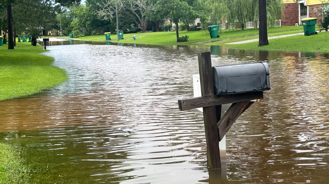
Between late Sunday and Monday morning, local weather reports indicated the storm dropped between 13 to 16 inches of rain, inundating roads, homes, and businesses. The National Weather Service (NWS) issued several flash flood warnings as water levels quickly rose across the island, causing flooded basements and submerged roads.
Record Rainfall Comparison
Kelleys Island usually receives about 4.1 inches of rain during July, as explained by NWS observing program leader Brian Mitchell. This recent weather event delivered nearly four times the island’s average monthly rainfall within hours. The previous state all-time rainfall record was 10.75 inches, set in Shelby County between August 7-8, 1995.
Although reports documented the extreme rainfall on Kelleys Island, Mitchell mentioned that it might take weeks for official records to reflect the event’s impact. WTOL chief meteorologist Chris Vickers noted rainfall measurements surpassed 17 inches, exceeding previous records and causing significant flooding.
Threat of Flooding and Infrastructure Challenges
Authorities advised residents to steer clear of flooded areas and conserve water, as village infrastructure faced challenges in handling the runoff. The rainfall exceeded the NWS’s 1-in-1,000-year event criteria, which requires 8.41 inches of rain within 24 hours.
Videos on social media showed water rushing through streets and pouring downhill, resembling waterfalls. Residents documented the extensive flooding of yards, basements, and businesses.
Understanding 1-in-1,000-Year Events
Meteorologists described the Kelleys Island rainfall as nearly a 1-in-1,000-year precipitation event. Contrary to what the name implies, such events indicate a rainfall magnitude with a 0.1 percent chance of occurring in any given year, not a rigid timeline between occurrences.
These classifications use historical climate data, but scientists caution that a warming atmosphere alters these odds. Warmer air can hold more moisture, enabling storms to produce heavier downpours than in cooler climates.
The Trend of Increasing Extreme Rainfall
The Kelleys Island flooding illustrates a broader nationwide trend towards intense precipitation events. The U.S. Global Change Research Program and National Climate Assessment found that the heaviest rainfall events have significantly increased across much of the country over the past century.
The Midwest and Northeast have experienced substantial increases in extreme precipitation. Scientists emphasize that while climate change doesn’t cause every individual storm, it shapes conditions that yield higher rainfall totals.
Investigating El Niño
El Niño, characterized by unusually warm waters in parts of the equatorial Pacific Ocean, can influence worldwide weather patterns. Its effects are typically broader and longer-term, affecting seasonal patterns rather than triggering specific storm systems. The Kelleys Island flood was directly linked to a slow-moving storm complex repeatedly affecting the area.
Next Steps
As floodwaters diminish, residents and officials assess the damage’s extent. Repairs may be necessary for roads, homes, businesses, and public infrastructure. Emergency managers remain vigilant, determining whether further state or federal assistance is necessary.
The NWS Cleveland office reports no current weather watches or warnings for the region.
 Data Centers in Virginia face Growing Opposition
  EPA Dismantles Greenhouse Gas Rules, Causing Concern
  How Battery Innovations Transform Renewable Energy
  Data Centers Stir Controversy in Texas Amid Growth Boom
  Urgent Archaeological Efforts in Quinhagak Stay Ahead of Erosion
  Concerns Rise Over NIPSCO Permit In Jasper County