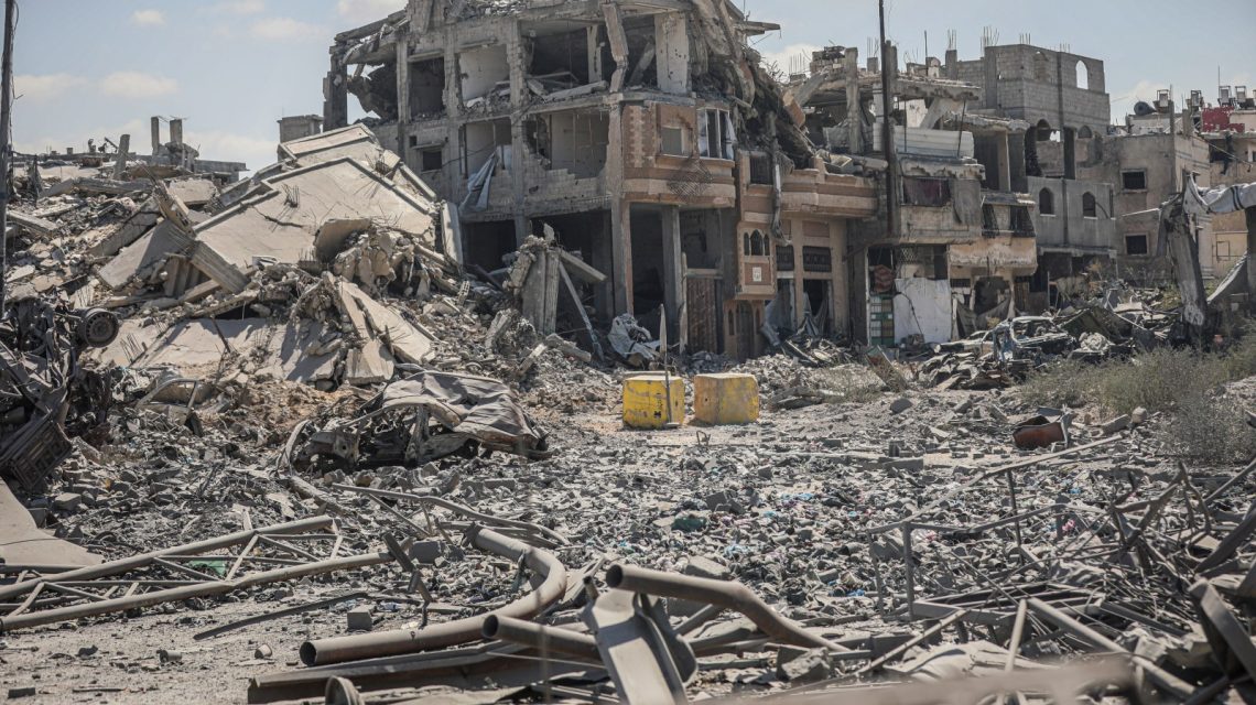
Google Earth images of Gaza have revealed the catastrophic destruction caused by the ongoing conflict between Israel and Hamas. These satellite images, which surfaced online, capture the aftermath of the Israeli military’s actions following Hamas’ attacks on southern Israel on October 7, 2023. Google Earth has not confirmed when these images were uploaded, but reports suggest some were captured earlier this year. Newsweek reached out to both the Israeli military and Google Earth for their statements.
Barry Andrews, an Irish Member of the European Parliament, expressed his reaction on X, formerly known as Twitter, to these Google Earth images showing entire districts turned to debris. The images received significant attention, amassing five million views, 30,000 likes, and numerous shares by Monday afternoon.
“The updated Google satellite images of Gaza are quite incredible, for all to see,” wrote Andrews, reflecting on the scale of flattened buildings captured.
Chris Doyle, director of the Council for Arab-British Understanding, spoke to Newsweek, stating that these images shockingly document the widespread devastation in Gaza, where at least 82 percent of buildings have been damaged or destroyed over the years. Doyle emphasized the global astonishment caused by these images and questioned when they might influence the stances of global powers, including the U.S.
Nathan Ruser, an analyst at the Australian Strategic Policy Institute, also commented on X, describing the imagery’s detail as both vivid and unsettling.
What Do the Google Earth Images Show?
The conflict’s toll is severe. According to the Associated Press and Gaza’s Health Ministry, Hamas’ October 7 attacks resulted in at least 1,200 deaths and over 250 kidnappings. Israel’s subsequent military actions have led to 74,016 Palestinian deaths and 175,068 injuries. A ceasefire enacted on October 10, 2025, curtailed the most intense fighting, although Israel continues airstrikes in response to ongoing threats.
The UN Satellite Centre (UNOSAT) reported in August that 82 percent of Gaza’s 200,000 structures suffered damage, with about two-thirds completely destroyed, a statistic that aligns with the latest Google Earth imagery.
The southern city of Rafah is prominently featured, with large areas previously lined with homes now mostly cleared, showing makeshift shelters scattered across the landscape. Satellite views of Gaza City depict destruction around Al Shifa Hospital, a site of heavy Israeli bombardment during the conflict. Israel accused Hamas of operating a command center in or beneath the hospital, allegations denied by both the group and its staff.
Rebecca Wolfe, an expert in conflict and humanitarian response at the University of Chicago’s Harris School of Public Policy, pointed out the insufficient discussion concerning the operational challenges during the Gaza conflict, given its small and densely populated nature. A United Nations report published last week highlighted that around 1.9 million residents of Gaza have been displaced, with many forced to relocate multiple times. The report also indicated that over 60 percent of the population lost their homes.
Wolfe noted that targets were often near critical infrastructure, putting civilians at risk. She added that while Israel was aware of the complex environment and the power of its weapons, alternatives to their use existed when targeting Hamas militants.
 Sudan’s Military Leader Rejects US Ceasefire Proposal Amid Visa Debacle
  The Department of Homeland Security Urges Migrant Caravan to Avoid U.S. Border
  Adam Brody’s Discussion on Political Activism and Israel-Palestine Conflict
  A Test of Leadership in Global Crises
  Investigators Uncover New Evidence in Missing Women Case Linked to Philadelphia Home
  WFP’s Challenge in Global Hunger Amid Conflict and Climate Change