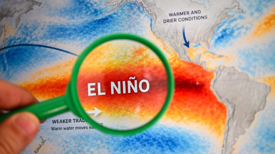
El Niño is showing signs of intensification across the tropical Pacific. Climate experts predict that this pattern might reach exceptional strength, influencing global weather patterns through the upcoming winter and into 2027.
Predictions and Analysis
The National Oceanic and Atmospheric Administration (NOAA) Climate Prediction Center gives more than a 90 percent likelihood of a very strong El Niño occurring in the fall and winter seasons. Similarly, the World Meteorological Organization (WMO) forecasts El Niño to peak near the end of 2026, with an intensity that could surpass historical records.
AccuWeather has said El Niño might become the strongest since 1950, increasing its potential impact on worldwide weather.
Understanding El Niño
El Niño forms part of the El Niño-Southern Oscillation (ENSO) and represents the warm phase of this recurring Pacific climate pattern. The cool counterpart is La Niña. Typical El Niño impacts include more storms in the Southern U.S., dry spells in northern regions, and shifts in hurricane activity.
“Super El Niño” refers to extremely strong events, although it is not an official designation by NOAA.
Expected Strength and Impact
“Over the next few months, the public should watch to see if El Niño continues to strengthen. El Niño is measured in the ENSO 3.4 region which is a designated area in the Eastern Pacific where sea surface temperatures are compared to climatology,” explained Alex DaSilva, an AccuWeather meteorologist. “If we see a record El Niño, there is a high likelihood that global temperatures in 2027 will be the warmest on record.”
According to NOAA’s August update, El Niño is projected to continue strengthening until late 2026, with a 69 percent chance of becoming “historic” by surpassing previous records dating back to 1950.
NOAA emphasizes that while higher likelihood of El Niño effects exists, these are not assured.
Meanwhile, WMO has acknowledged El Niño’s firm establishment, with expectations of its continuation into a very strong phase over coming months. Nearly 100 percent probability exists for El Niño’s persistence until February 2027 according to forecasts from its Global Producing Centres.
WMO has signaled potential changes in rain and temperature patterns, heightening flood, drought, and heat risks. Forecasts indicate above-normal temperatures might occur in most land areas from September to November, although El Niño strength alone does not dictate severity, as impacts vary regionally and seasonally.
Regional Implications
AccuWeather’s updates suggest “Super El Niño” conditions are expected in the Atlantic hurricane season’s second half, predicting the 2026-27 event as potentially the strongest since at least 1950. “We are seeing a strong impact in both the Atlantic and Pacific basins,” noted Paul Pastelok, AccuWeather’s Lead Long-Range Meteorologist.
For the United States, forecasts show an active southern storm track, increased temperatures in the northern regions for autumn, and ongoing “extreme and exceptional” drought conditions in the West.
DaSilva from AccuWeather commented that current observations position this El Niño as among the strongest recorded. Whilst it shows record-breaking daily values, sustained long-term strength is necessary for it to be declared the strongest.
 EPA Dismantles Greenhouse Gas Rules, Causing Concern
  How Battery Innovations Transform Renewable Energy
  Data Centers Stir Controversy in Texas Amid Growth Boom
  Urgent Archaeological Efforts in Quinhagak Stay Ahead of Erosion
  Concerns Rise Over NIPSCO Permit In Jasper County
  Reader Reactions on Grizzlies and Data Centers