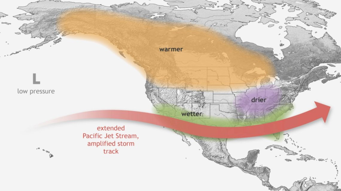
Major cities, including Los Angeles and Atlanta, could experience intensified rainfall, flooding, and other disruptive weather patterns this winter. Meteorologist Paul Pastelok from AccuWeather informed Newsweek about the potential changes due to the strengthening of El Niño.
Federal forecasters have projected that El Niño will intensify towards the end of the year. There is a greater than 90 percent chance it will evolve into a very strong phenomenon during the fall and winter months.
Understanding El Niño
El Niño represents the warm phase of the El Niño-Southern Oscillation (ENSO), a recurring climate pattern affecting global weather. Its counterpart, La Niña, signifies the cycle’s cooler phase.
Common impacts of El Niño include stormier conditions in the southern regions, drier conditions in northern areas, and variations in hurricane frequency. Previous strong El Niño events have aligned with significant weather extremes. For instance, the 1997-98 Super El Niño led to severe flooding in California and Peru, while the 2015-16 event coincided with global temperature records and widespread climatic disruptions.
Cities Most Affected by Winter Weather Changes
Pastelok highlighted that cities such as Los Angeles, San Francisco, Houston, and Atlanta might expect increased rainfall and potential flooding due to a dominant El Niño. Typically, a southern storm track occurs more frequently during late fall and winter. California, with its unique landscape, may face heightened landslide risks.
Additionally, Pastelok noted the possibility of rising river levels along the Mississippi, Tennessee Valley, and the Carolinas, potentially affecting cities in these regions.
The East Coast could experience powerful storms leading to coastal flooding and strong winds, especially in cities like Norfolk, Virginia, Atlantic City, and Boston, Massachusetts.
Insights from NOAA’s Winter Forecast
The National Oceanic and Atmospheric Administration’s (NOAA) Climate Prediction Center (CPC) released temperature and precipitation forecasts for December 2026 through February 2027. The temperature forecast suggests above-normal conditions across a wide area, including the Pacific Northwest, northern Rockies, Plains, Midwest, and Northeast. The strongest warm signal appears along parts of the northern tier of the country.
Above-normal temperatures are also anticipated in much of the South, though the forecast is less clear for parts of California and the Southwest.
Regarding precipitation, NOAA predicts wetter-than-normal conditions extending from Southern California across the Southwest, southern Plains, Gulf Coast, and into Florida and the East Coast.
A recent update from the CPC indicates a 75 percent likelihood El Niño will reach unprecedented strength between October and December, surpassing events recorded since 1950. This probability has grown from 69 percent since the agency’s August update. However, an event of this magnitude does not guarantee specific El Niño weather impacts.
Newsweek editors Ben Kelly and Anthony Murray contributed to this story.