Hurricane Simon Intensifies Off Mexico’s Coast
Hurricane Simon is escalating swiftly along Mexico’s Pacific coastline. The U.S. National Hurricane Center reported that on Friday, Simon’s maximum sustained winds surged to near 90 mph (150 kph).
Projections indicate Simon will evolve into a formidable Category 4 hurricane by Saturday. It is anticipated to approach the southwest and west-central coastal areas of Mexico, known for attracting tourists.
Isaias Moves Toward Major Hurricane Status
Hurricane Isaias continues to strengthen this morning, achieving sustained winds of 110 mph (175 kph). This momentum positions Isaias on the brink of becoming a Category 3 hurricane, according to a National Hurricane Center advisory.
“Preparations should be rushed to completion as the weather will go downhill quickly today,” the statement warned.
“Isaias is likely to become a major hurricane this morning. Slight weakening is expected before landfall, but it is expected to remain a dangerous hurricane,” it added.
Assessment of the Current Atlantic Hurricane Season
This year marks a notable change, as there had been no hurricanes in the Atlantic Ocean by late September for the first time in 75 years. Hurricane Isaias stands as the initial hurricane of the 2026 season, which was projected to be less active.
In May, the National Weather Service predicted a 55% chance of a below-normal hurricane season, increasing to 75% by August. The latest forecast anticipates seven to 13 named storms, with two to six becoming hurricanes. Of these, zero to two could reach Category 3 status or higher.
In an average year, the season includes 14 named storms, seven hurricanes, and three major hurricanes, as per the National Oceanic and Atmospheric Administration. Isaias represents this year’s ninth named storm in the Atlantic, with prior storms largely remaining tropical.
In contrast, the first hurricane of last year, Erin, emerged in August as a Category 5 storm near Cape Verde without impacting the U.S. The Atlantic hurricane season spans from June 1 to November 30.
Preparations in Alabama and Florida
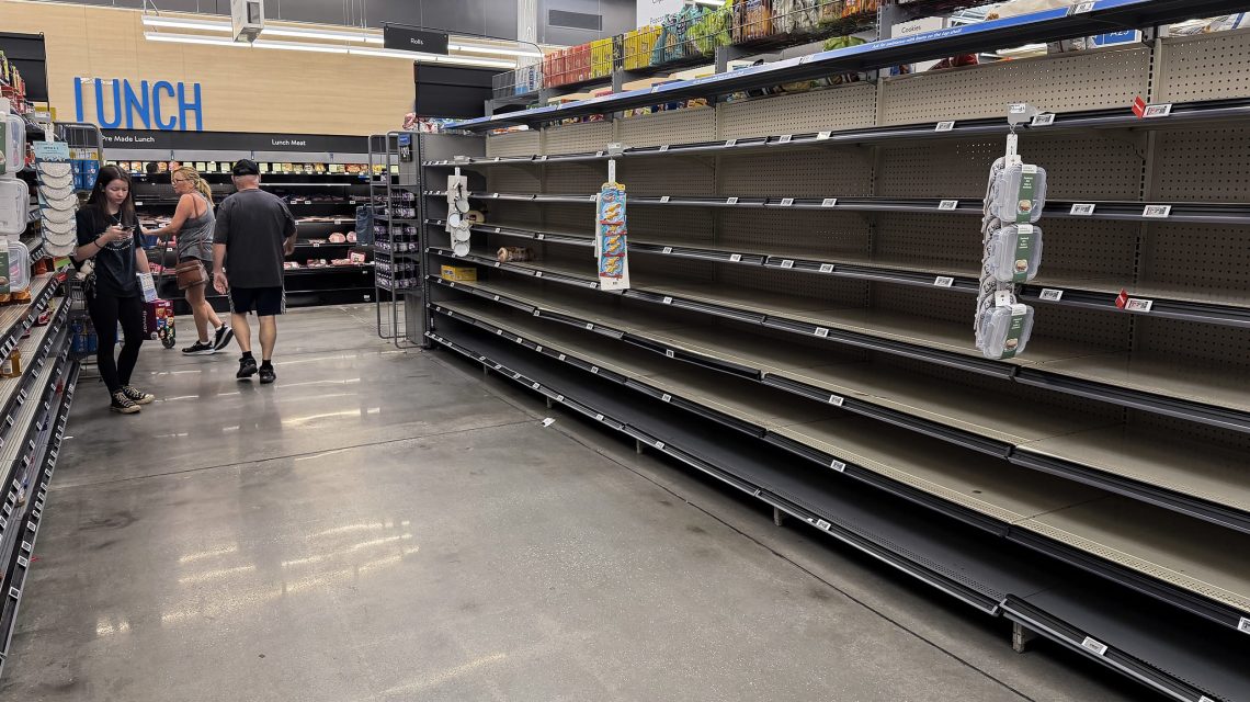
Residents in Alabama and Florida are getting ready for Isaias’s potential landfall. Images show empty bread aisles in Walmart locations in Gulf Breeze, Florida, reflecting public preparation efforts.
Donald Knapp has been seen securing his Islander Ice Cream restaurant with plywood in Gulf Breeze, Florida. Meanwhile, workers are installing shutters on Doc’s Seafood Shack in Orange Beach, Alabama. Taylor Chandler was spotted carrying sandbags in Orange Beach, as well.
Comparing Atlantic and Pacific Hurricane Activity
While Isaias approaches the Gulf Coast, the Pacific has demonstrated higher activity levels. Earlier hurricanes, like Lala in August, resulted in fatalities; Lowell caused damage on Kauai; and Nolo moved south of Hawaii.
This season’s first hurricane in the Pacific, Fausto, emerged mid-July. NOAA predicted an active eastern Pacific hurricane season with a 70% likelihood of heightened activity from May 15 to November 30.
Phil Klotzbach, a scientist at Colorado State University, attributes these changes to an El Niño system. El Niño, a pattern of rising sea temperatures in the eastern Pacific, results from wind reductions near the equator.